Welcome to LPD SURVEYS – Licensed Land Surveyor in Perth
Perth Surveyors servicing all of WA – Licensed 3D spatial experts on the land and in the air
LPD SURVEYS are a team of Professional Engineering & Land Surveyors. Specialising in engineering, construction, mapping, infrastructure, UAV, laser scanning, spatial modelling, mining, land development and dilapidation surveying services.
Our team of property surveyors Perth are committed to providing industry leading Surveying services that exceed our clients’ expectations. Spanning four offices and servicing the whole of Australia.


Capability Statement including Laser Scanning & UAV Lidar Project Videos
Valued Clients


Frequently Asked Questions
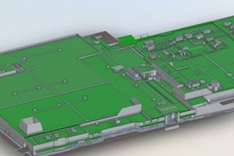
Deliverables typically include detailed survey drawings, digital coordinate data, contour plans and documentation suitable for planning approvals or construction. For more complex projects, outputs can integrate into CAD or BIM workflows used by architects and engineers.
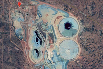
LPD Surveys is based in Perth, Western Australia, but operates across both metropolitan and regional WA, including civil and mining projects. Service delivery is not limited by location; it is structured around project requirements.
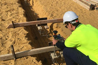
Modern surveying combines licensed land surveying expertise with technologies such as GNSS positioning, total stations, UAV aerial mapping and laser scanning. The result is highly accurate spatial data suitable for engineering design, construction set-out and legal documentation. The core principles remain the same; however, data capture is now faster and more detailed.
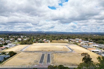
LPD Surveys supports residential, commercial, civil and mining-related projects across Western Australia. This includes individual residential lots through to large-scale infrastructure and industrial developments. Services may cover boundary definition, feature and contour surveys, engineering set-out, aerial surveys and advanced 3D capture, depending on project scope.
You should involve a surveyor as early as the feasibility or design stage. Accurate site data, including boundaries, contours and existing features, directly informs architectural design, engineering calculations, drainage planning and compliance with WA requirements. Engaging LPD Surveys early helps reduce the risk of redesign costs and construction delays caused by incomplete or incorrect site information.
Associations and Community Sponsorship