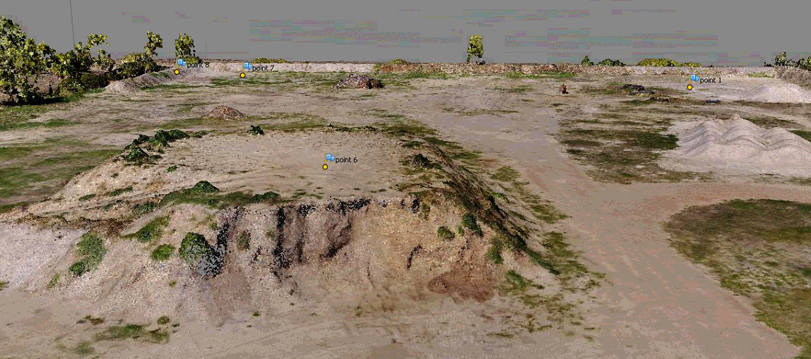
View Larger Image Young Road, Baldivis – Retrospective Fill/Volume Surveymgadmin2018-06-28T15:42:49+08:00 May 2017 Cadastral boundary re-establishment Feature survey – determining AHD levels and volumes 3D UAV (Drone/RPAS) Survey and Plan Deliverables included Orthomosaic, 3D textured Point Cloud and 3D Visualisation Project Details Categories: Drone Inspection, UAV Lidar & Photogrammetry Models & 3D Laser Scanning Perth Related Projects Tank Silo Laser Scanning Perth Project – Musson Road, Wattleup October 4th, 2023 Industrial Building Laser Scan for re-build after fire damage, Kurnall Road WELSHPOOL July 23rd, 2023 IGA Shopping Centre – Laser Scanning survey for internal ceiling plan for upgrades after water damage – Craigee Plaza PERTH July 23rd, 2023