For landowners, developers and project teams, 3D digital twins now mean more than a set of lines on a plan. They provide a practical way to capture a site in rich detail, test decisions earlier and reduce costly surprises before design, subdivision or construction begins.
The shift matters because Western Australia is investing in a state-level spatial digital twin through Spatial WA. This guide explains why that matters on the ground, where the method adds value, and what readers should consider before relying on it.
Key takeaways
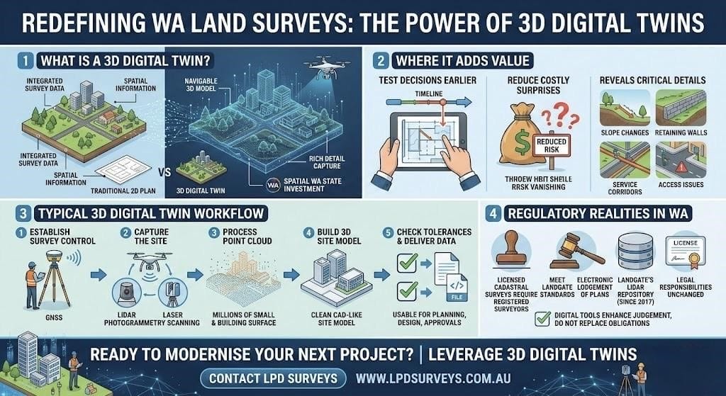
- A digital twin combines survey capture, spatial data and a usable 3D model, offering clearer context than a conventional 2D plan.
- In WA, licensed cadastral work still operates within established legal and survey standards, even when capture methods evolve.
- Modern land surveys in WA increasingly use dense point clouds, GNSS control and digital lodgement to improve coordination.
- Landgate’s LiDAR repository includes acquisitions since 2017, confirming that detailed 3D data is already part of the state’s spatial framework.
Why 3D Digital Twins matter now
Surveying has always been about certainty: where a boundary sits, how land falls, what constraints exist, and what can safely be built.
The difference now is that clients often need those answers in a format that engineers, planners and asset teams can use immediately. A digital twin achieves this by combining field capture with a navigable model, rather than requiring each discipline to interpret separate datasets.
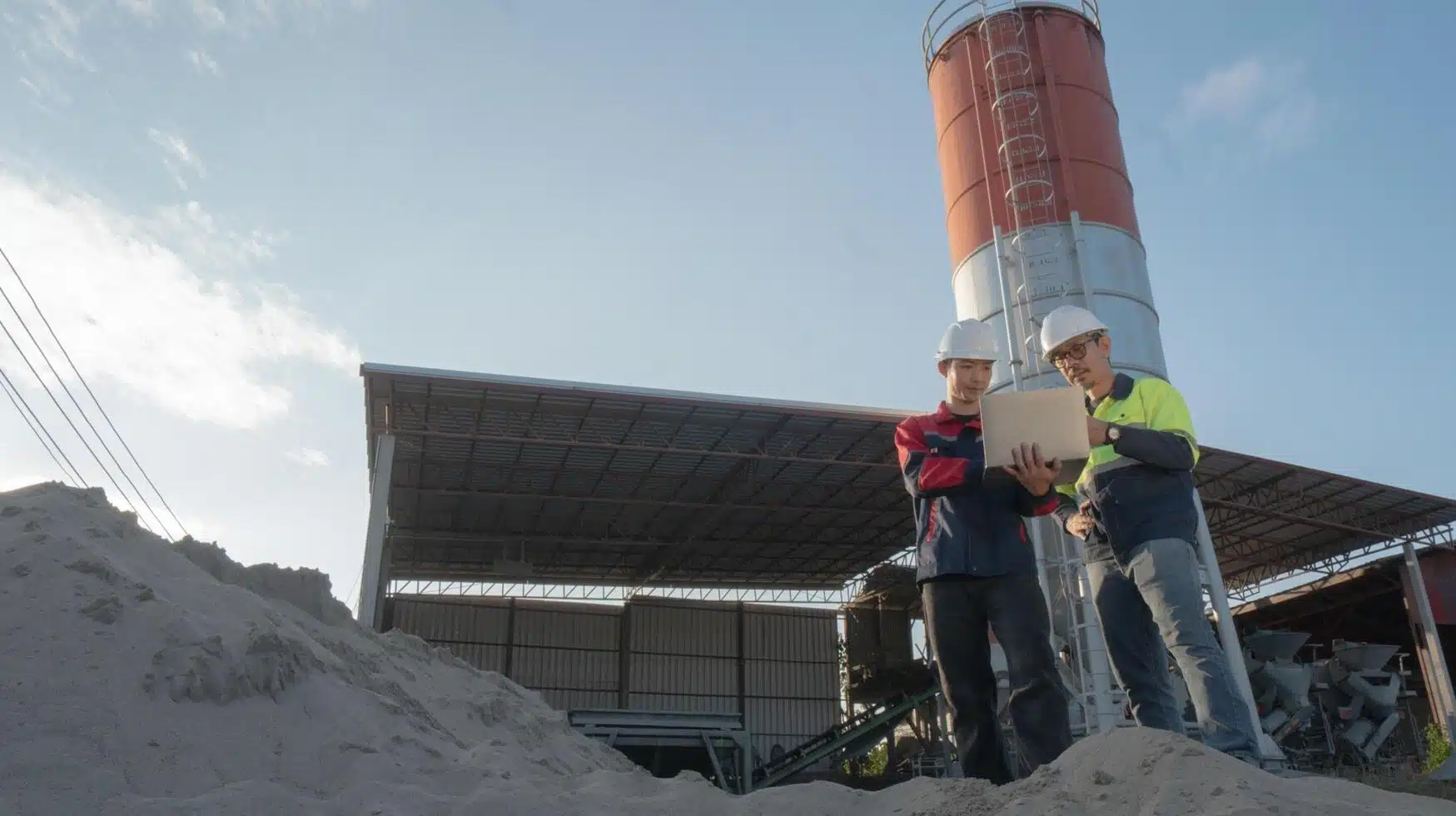
In practical terms, 3D scanning for land development helps identify slope changes, retaining interfaces, service corridors and access constraints earlier in the process. This does not replace a licensed surveyor’s judgement; it supports it with clearer, measurable context.
Why 3D Site Models Make Survey Data Easier to Use
In metropolitan Perth and across WA, a 3D model is often easier for non-specialists to interpret than field notes and contours alone. This is where terrestrial laser scanning becomes valuable: it captures buildings, kerbs, walls and surface features efficiently, then converts them into a point cloud that can be validated against survey control and shared across project teams.
The key advantage is not the model itself; it is the earlier identification of site risks before design assumptions lead to costly variations.
How a 3D Digital Twin Survey Works
A typical workflow is straightforward:
- Establish survey control in line with accepted WA standards.
- Capture the site using LiDAR, GNSS, photogrammetry or a combination of methods.
- Process the point cloud and develop a 3D site model.
- Validate outputs against required survey tolerances.
- Deliver usable data for planning, design and approvals.
In WA, digital survey methods must still comply with formal requirements. Landgate requires survey work, plans and field records to meet recognised standards, with many documents lodged electronically in line with current practices.
This is important because legal responsibilities remain unchanged, regardless of the technology used. Cadastral surveyors in WA must be appropriately registered and hold a current practising certificate. Digital tools improve clarity, but do not replace professional or statutory obligations.
The primary advantage lies in improved data capture and faster information sharing. High-accuracy LiDAR mapping records detailed points across land and structures, while real-time spatial data enables teams to work with current, reliable information.
Comparison at a glance
| Approach | Best for | Main strength | Main limitation |
|---|---|---|---|
| Traditional 2D survey | Boundary definition, basic feature surveys | Clear legal survey output | Harder for non-specialists to interpret |
| 3D digital twin survey | Complex sites, planning, coordination | Better visual context and clash detection | Higher processing requirements |
| Hybrid workflow | Subdivision and development projects | Balances legal precision with practical site insight | Needs disciplined data management |
Also Read: Essential Guide to Land Surveys in Perth: Types, Uses, and When You Need One
Frequently Asked Questions:
- How do 3D digital twins improve land survey accuracy in WA?
They improve understanding more than altering the legal basis of a survey. Higher capture density, clearer site context and easier cross-checking reduce missed features and drafting assumptions, while control and verification must still meet accepted WA survey standards. - What is the cost of a 3D digital twin survey in Perth?
There is no fixed rate. Costs depend on site size, access, capture method, required accuracy, processing time and deliverables. A small urban lot may be relatively modest; complex industrial or infrastructure sites typically require a tailored scope and quotation. - How are digital twins different from traditional land surveys?
A traditional survey delivers plans, levels and coordinates. A digital twin adds a navigable 3D environment built from measured data, helping teams review conditions, compare options and communicate constraints beyond standard 2D outputs. - What industries in WA benefit most from 3D digital twin mapping?
Property development, civil infrastructure, local government, utilities, ports and resources benefit most where site complexity is high. 3D digital twins are also well suited to remote mining operations across Western Australia. - How does WA legislation affect digital twin data collection?
While collection methods may change, legal obligations remain. Where work affects cadastral outcomes, licensed surveyors, approved practices and Landgate requirements continue to apply, particularly for control, plan preparation and lodgement.